MSF Mapathon at Universitat de València
Published on at geo, 3 mins.
Last week for the first time since the pandemic I attended a Mapathon in person. With the geomaticblog.net retired, this is my first geospatial post on my own website 😱.
What’s a mapathon?
For those that don’t know the term, a mapathon is a gathering of volunteers to do some remote mapping with the objective of improve the cartography of an area of the world that does not have a proper map. Yeah, there’s yet plenty of those spaces in the world 😢.
There are two types of mapathon depending on the nature of the event that causes it:
In the event of a natural or human disaster like an earthquake, a massive flood, etc. the OpenStreetMap community gathers to create data so agencies and entities on the field can understand better where people may be located, how to get there, etc. This is very time sensitive so usually the mapping starts immediately and mapathon organizing teams need to be fast to get the facility (usually a University laboratory).
On the other hand, there is a joint effort started by Red Cross and Doctors Without Borders (MSF) called Missing Maps that uses the same approach and tools, but in a more proactive way. These NGOs identify where they need data based on their missions and field activities and request to the OSM community to help them with their mapping. This is an activity that can be planned way in advance and usually gathers more people. It is also a perfect place to train new mapping volunteers but it may lack the sense of urgency and purpose if there’s no clear communication on how the data being gathered will be used.
1 minute video from MSF about mapathons
MSF & Universitat de València mapathon
The mapathon I attended last week was a Missing Maps effort. It was organized by MSF, as part of a global effort, and thanks to València Geography Faculty, this was my biggest mapathon attended ever, with more than a hundred people volunteering (mostly students).

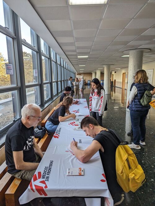
Mapathon registration desk
The event lasted three hours, split into:
- Around 50 minutes of an all-hands gathering to give an introduction to MSF, the mission they are doing in Kenya in Homa Bay county and how the data gathered will be used.
- Group splits in three different laboratories for mapping in different tasks
- Everyone gets back to the main room for some closing remarks
Most of the attendance were new mappers and Geography students, so they knew about how to interpret imagery and how to trace buildings even though it was their first OSM exposure for many of them.

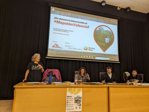
Mila Fonts (MSF) welcomes attendees
On my end I was available to help here and there and managed to map around a hundred buildings, but I was mostly busy trying to understand why there were some students being blocked by OSM. It seems a new anti-vandalism procedure was understanding some student uploads as non-legit and it was blocking their changesets. Fortunately this was not super common and only a few (as far I saw) were affected. Yet, this is something to follow up to update the procedure on mapathons.
I like mapathons because they are an excellent opportunity to grow OSM community, not just for Humanitarian missions (that give a lot of sense of purpose) but also to maybe, onboard them improve their local neighborhoods. I hope MSF sees the value on this activity as I do, and they keep engaging with Universitat de València and others to organize more mapathons in the future.